Live: Buy Two and get 30% off!
The History & Evolution of Ancient Star Maps

Author:
Kevin
Updated:
From the earliest cave drawings of constellations to the sophisticated digital sky maps of today, mapping of the stars serves as a testament to humankind's eternal fascination with the cosmos.
Star maps have played a crucial role in navigating our understanding of the universe, as well as understanding ourselves. They've guided sailors across vast oceans, inspired myths and legends, and fueled our dreams of space exploration.
And star maps, as you might already have guessed, aren’t exactly new. Ancient star maps show how some of the oldest civilizations on Earth understood the astrological wonders, maybe even on a whole other level compared to today.
So, let’s explore the history of star maps. Why were star maps invented? How did the ancients map the stars? Who made the first star map? What is the oldest star map on Earth? We answer these questions and more below. So, let’s take a journey through time, uncovering the vast history of the cosmos and star maps.
Why Were the First Maps of Stars Created?

Looking at an old star map isn’t the same as looking at one today. Inevitably, civilizations before us may have lacked some technology to gain greater insights. Additionally, many old ancient maps incorporated an aspect of art into their drawings. But when were star maps invented?
The oldest and most accurate star map is thought to come from Ancient Egypt around 1500 B.C. Prior to that, star maps existed but weren’t as accurate as what is depicted on star maps today.
The very first star maps were invented for various reasons. These included navigational aids, religious or cultural significance (such as striving to be closer to the gods), agricultural calendars, and even simply human curiosity. Below, we take a closer look at which ancient civilization created the first star catalogue and maps—and how this translates over into the modern era today.
Babylonians and Egyptian Star Maps
The night sky and astronomical cycles played significant roles in the Babylonian and Egyptian lives. It offered the foundation for religious ceremonies and traditions. In fact, it arguably guided their whole way of life.
The Ancient Egyptians, specifically, carved star maps into tombs and burial chambers, indicating their significance and importance. For example, the constellation of Orion was linked to Osiris, the god of the afterlife, which is commonly found at burial sites.
These Egyptian star maps were vibrant, with stars often shown as dots or small circles, surrounded by depictions of deities or mythological creatures. In fact, pieces of the Egyptian star maps spilled over into Ancient Greece, with Greek astronomers adapting certain systems first used by the Egyptians.
Ancient Greek Star Maps
Ancient Greek star maps feature the graphics and names of many constellations we know today. In fact, the Greeks are attributed for significantly advancing the field of astronomy and our understanding of the night sky. Many of the constellations named by the Greeks linked back to Greek mythology. For instance, Hercules, Perseus, and Cassiopeia all found their place among the stars in Greek star maps. Prominent Greek astronomers, such as Hipparchus and Ptolemy, also made significant strides in the accuracy of star mapping.
If you’re wondering who created the first map of the stars, most credit the Ancient Greek astronomer Hipparchus. Hipparchus's map of stars became one of the earliest known star catalogues, listing around 850 stars with their positions and brightness levels. Ptolemy's work, the "Almagest," expanded on this, offering a comprehensive view of the heavens with mathematical models for celestial movements.
Introducing new tools and methods for mapping the stars, the Greeks set the stage for many principles and practices in modern astronomy. Moreover, their integration of mythology with science has left a lasting imprint, with many constellations and celestial phenomena retaining their Greek names and stories.
Roman Star Maps
The Roman Empire built on the rich foundations laid by the Greeks when it comes to the old ancient star maps of the world. For instance, many Greek constellations were adopted by the Romans, but they often assigned them new names or narratives rooted in Roman myths and legends. An example of this is the Greek constellation Lyra, which became associated with the story of Orpheus and his lyre in Roman tradition.
Since the Roman Empire was large and vast, this civilization depended on star maps for navigation, trade, and transportation. This was especially important for the shipment of goods across the Mediterranean Sea.
Star maps were also popular in Roman artwork and architecture, with various mosaics depicting zodiac signs, planets, and constellations.
Ancient Chinese Star Maps
Unlike the constellations of the Western world, which predominantly took the forms of mythical creatures and legendary heroes, Chinese constellations were often linked to the daily lives and concerns of its people. The sky was divided into sections that represented palaces, and these areas held importance for different aspects of life, such as agriculture, governance, and family.
One of the prominent features of Ancient Chinese star maps was the division of the ecliptic plane into 28 segments, known as the Lunar Mansions. These segments, associated with the Moon's path through the stars, played a pivotal role in the Chinese lunisolar calendar and agricultural practices.
These star maps further often reflected the delicate balance between Earth and heaven, with the stars and other celestial bodies viewed as omens that directly impacted events on Earth.
The ancient Chinese were further meticulous in recording celestial events. Solar and lunar eclipses, supernovae, and comet appearances were diligently documented, providing astronomers with valuable information from the past today.
Medieval Star Maps
The Medieval times brought about great change in human life and various civilizations. During this time, monasteries became centers of learning and knowledge preservation.
Many monasteries had observatories where monks recorded celestial events, drawing inspiration from both religious scriptures and ancient astronomical texts. These observatories often produced star maps that fused religious iconography with scientific observation.
New astronomical tools, such as the astrolabe, were widely used during the medieval period. Astrolabes, often ornately designed and inscribed with star positions, allowed for more precise astronomical calculations and observations. However, these instruments were not just tools for scholars; they were also often used for navigation, timekeeping, and religious purposes.
As the medieval period drew to a close, the stage was set for the Renaissance—a time of renewed interest in arts, sciences, and exploration. The star maps and astronomical tools of the medieval era played a foundational role in the astronomical revolutions that would soon follow.
Modern Star Maps
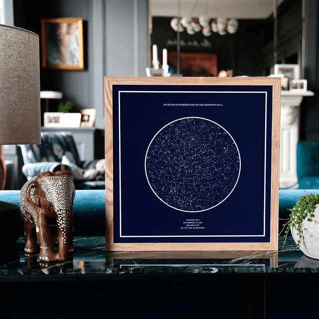
Compared to antique star maps and ancient sky maps, modern star maps are now digitized and be generated from anywhere in the world. Take us here at The Night Sky, you can even choose any special moment, date, time and location transform it in a piece of art or jewelry.
With the ability to capture images of the stars at an exact point in time, star maps are more accurate than ever before. Space-based observatories, such as the Hubble Space Telescope and the Gaia satellite, further provide data for modern star maps without distortions from Earth’s atmosphere.
It’s also awe-inspiring and incredible to note that as we gaze upon these modern maps, we are not just looking at the stars; we are witnessing the cumulative legacy of millennia of stargazing, research, and shared human wonder.
Exploring Ancient Star Maps Most Common Questions
What is the oldest star map in the world?
Today, Hipparchus's star catalogue is considered the oldest star map in the world. And surprisingly, it was incredibly accurate. This star map was the first time two coordinates were used to pinpoint the location of a single object or celestial body in space.
Why were star maps invented?
Star maps were originally invented to establish some sense of order and predictability. They also allowed for easier navigation and planning, giving way to eventual trade routes and more.
Who made the first accurate star map?
Hipparchus, an Ancient Greek astronomer, was the first to make the most accurate star map, which is still around to this very day.
How old is the oldest star chart?
The oldest star chart dates back to Egyptian times around 1534 B.C.
What is the oldest constellation identified by human civilization?
Taurus the Bull is the oldest named constellation. Surprisingly, many different ancient civilizations interpreted this collection of stars as a bull, which has stuck around in modern times and is now one of the 12 birth constellations.
How did the ancients navigate by the stars?
Well, it wasn’t easy. The only point of reference Ancient civilizations had to go off of was a sextant, which is the angle between the sun and the horizon. As time progressed, others started to use the height of stars from the Earth for navigating and mapping. Today, we’re lucky to have various technologies, star map generators and tools that make this process a million times easier.
Create Your Own Modern-Day Star Map with The Night Sky
From the first star map in Ancient times to modern star maps, humans have always been curious about what lies beyond our own reach. And in an age where our understanding of the cosmos is more profound than ever before, there's a unique charm in personalizing this vast knowledge.
The Night Sky offers everyone, regardless of their astronomical expertise, the opportunity to craft their own star map. Whether you're commemorating a special date, a cherished memory, or simply capturing the wonder of tonight's sky, this modern tool bridges the cosmic and the personal.
By inputting a date, time, and location, you can generate a map that displays the precise arrangement of stars and celestial bodies from a special moment in time.
Create your custom star map today!


